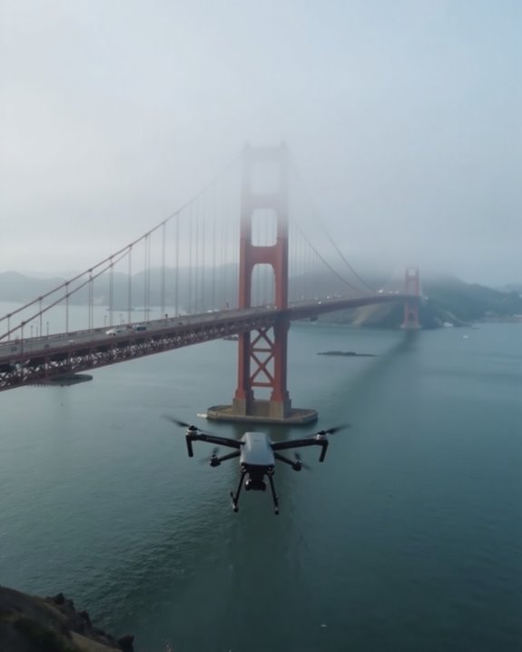
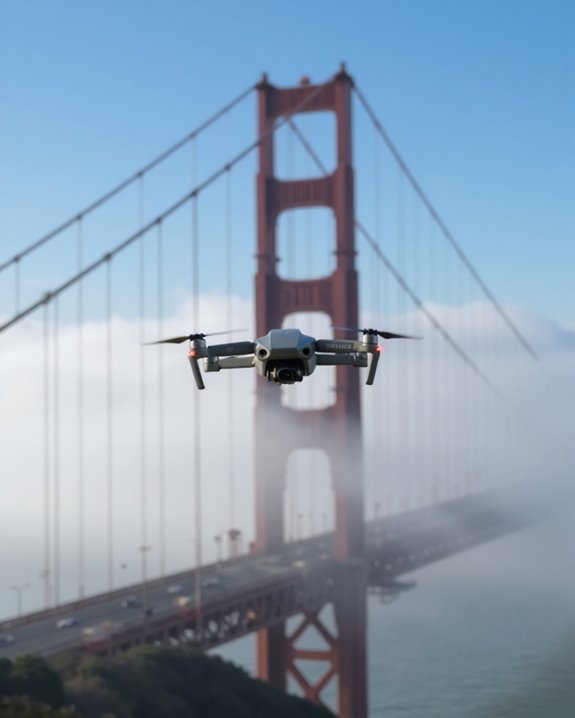
Flying a drone near the Golden Gate Bridge is prohibited without special permission. The National Park Service bans drone launches and landings on surrounding property, while the FAA oversees the airspace. Don’t risk hefty fines or confiscation! Creative photographers can legally capture stunning bridge footage from boats or designated areas outside GGNRA lands. The complex jurisdictional overlap creates confusion, but safety concerns remain paramount given the bridge’s traffic and wind conditions. Alternative drone-friendly locations offer equally impressive Bay Area views!
Key Takeaways
- Drone launches and landings are prohibited on Golden Gate National Recreation Area lands without prior written approval from NPS.
- The airspace around the bridge is not officially designated as a no-drone zone by the FAA, creating jurisdictional confusion.
- Legal alternatives include launching from boats in the water or from areas outside GGNRA jurisdiction.
- Flying near the bridge poses serious safety hazards due to wind turbulence, traffic, tourists, and frequent fog conditions.
- Enforcement involves both FAA and NPS authorities who can confiscate unauthorized drones and issue significant penalties.
Current Drone Regulations for the Golden Gate Bridge Area
The dramatic red span of the Golden Gate Bridge might seem like a perfect backdrop for your drone photography, but handling the regulations around this iconic landmark requires careful attention! The National Park Service strictly prohibits launching, landing, or operating drones on NPS lands within the Golden Gate National Recreation Area without explicit written approval. While the FAA hasn’t designated specific no-drone zones around the bridge, security concerns have led to strict enforcement.
Even with proper Pilot Certification, you’ll face significant restrictions. Many drone operators maintain detailed Flight Logging records to demonstrate compliance when questioned by authorities. Remember, unauthorized drones may be tracked and confiscated! The good news? There are legal alternatives, including water-based launches from boats, or seeking specific FAA waivers for commercial photography work. For enhanced security, some areas use drone jamming technology to prevent unauthorized drone flights near sensitive landmarks.
Understanding Jurisdiction: NPS vs. FAA Authority
Why do drone enthusiasts often find themselves caught in a regulatory tug-of-war when flying near the Golden Gate Bridge? The answer lies in the complex Jurisdictional History of airspace control in the area.
The FAA maintains exclusive authority over all U.S. airspace, while the National Parks Service controls the ground surrounding the iconic bridge. This Authority Evolution has created a peculiar situation where flying a drone through the airspace might be technically legal under FAA rules, but launching or landing on NPS property is prohibited! Confused yet? You’re not alone.
The airspace above the Golden Gate Bridge isn’t designated as a no-drone zone by the FAA, but good luck finding a legal takeoff spot nearby. This jurisdictional overlap creates enforcement challenges that leave many drone pilots scratching their heads. Using an FAA-compliant remote ID module with precise GPS tracking can help pilots maintain compliance and safety in such complex airspace environments.
Legal Ways to Capture Aerial Footage of the Bridge
Despite the jurisdictional complications, determined drone enthusiasts still have several legal options for capturing breathtaking aerial footage of the Golden Gate Bridge!
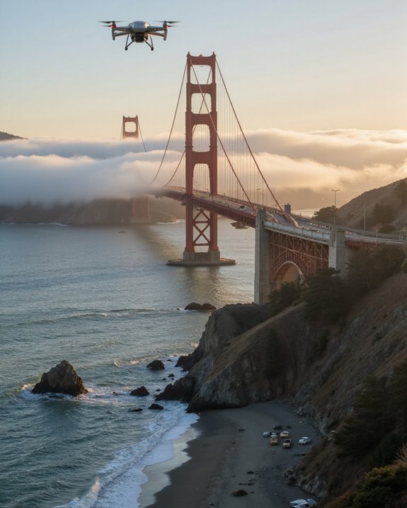
Launching from a boat provides one of the most effective methods, allowing photographers to frame stunning composition shots while staying compliant with regulations. When using this approach, focus your photographic techniques on side angles rather than directly overhead views. Many professionals navigate San Francisco Bay’s waters specifically for this purpose, carefully positioning their vessels to capture the bridge’s magnificent span against the city backdrop!
Alternatively, consider launching from areas outside GGNRA property, such as specific locations in Marin County. Remember, the secret to great bridge photography isn’t flying directly above it—it’s finding creative angles that showcase its majesty while respecting the rules!
Using a lightweight drone like the Holy Stone HS360E can help you stay within FAA regulations while capturing high-quality 4K footage from legal distances.
Safety Risks and Considerations When Flying Near the Bridge
Flying near iconic landmarks comes with significant safety challenges that every drone enthusiast must recognize before launching! The Golden Gate Bridge area presents particularly treacherous conditions, with notorious wind turbulence that can send even experienced pilots’ drones plummeting onto traffic below. Battery failures while hovering above this busy thoroughfare could trigger multi-vehicle accidents or injure pedestrians enjoying the bridge’s scenic walkways.
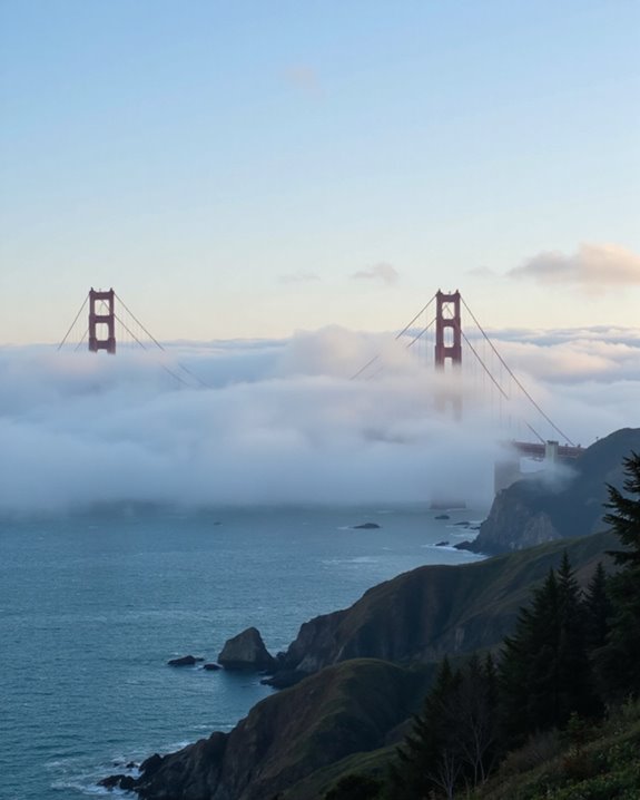
The bridge’s crowded environment, combining vehicles, cyclists, and tourists, creates a complex navigational challenge that’s extraordinarily risky. Emergency response to drone-related incidents puts additional strain on local resources, and wildlife disruption is a significant concern too. Remember, those gorgeous fog patterns that make the bridge so photogenic? They’re also precisely what makes maintaining drone stability nearly impossible! Your amazing footage isn’t worth creating a hazardous situation for others enjoying this magnificent landmark.
Enforcement Challenges and Compliance Strategies
Enforcing drone regulations around the Golden Gate Bridge represents a tangled web of jurisdictional challenges that confounds even the most diligent authorities! The FAA controls airspace while other agencies manage ground activities, creating a perfect storm of regulatory overlap. This confusion often leaves drone operators scratching their heads about whose rules to follow.
Despite prohibition signs, dozens of unauthorized flights occur monthly, with authorities struggling to track violators in real-time. Future Automated Systems could revolutionize enforcement by instantly detecting unauthorized drones. Meanwhile, public education campaigns remain vital, with authorities encouraging community reporting of illegal flights.
Legal alternatives do exist—launching from boats below the bridge (while still following FAA regulations) provides stunning perspectives for photographers. Ultimately, effective enforcement requires Global Cooperation between federal agencies, local law enforcement, and educated drone enthusiasts working together to protect this iconic landmark.
Alternative Drone-Friendly Locations in the Bay Area
While the Golden Gate Bridge remains off-limits for drone pilots, the San Francisco Bay Area offers several spectacular alternatives that won’t land you in hot water with authorities!
Blue Park on Yerba Buena Island provides stunning city skyline views without crossing restricted airspace. Similarly, Berkeley’s Cesar E. Chavez Park offers 90 acres of open space perfect for both community events and drone enthusiasts – just watch out for those kite flyers! The South Bay Area features Seacliff Beach State Park, a coastal paradise for aerial photographers seeking ocean panoramas. Don’t overlook the Presidio Area, where you can capture breathtaking natural landscapes while respecting State Park boundaries.
All these locations fall under Class G airspace, making them legally accessible for recreational drone pilots. Remember to check the B4UFLY app before heading out – the views are worth the extra preparation!
Frequently Asked Questions
What Are the Penalties if Caught Flying Illegally Near the Bridge?
Illegal drone operations can incur substantial penalties. Violators face drone fines up to $27,500 for commercial violations, potential equipment confiscation, and legal ramifications including prosecution, especially when flying over people or critical infrastructure.
Can Drones Interfere With Bridge Traffic Monitoring Systems?
Potential problems persist with drones potentially causing signal interference in traffic monitoring systems. Frequency conflicts could compromise communication infrastructure, though specific instances at the Golden Gate Bridge haven’t been documented in available information.
Are There Seasonal or Time-Of-Day Restrictions for Drone Flights?
No official seasonal winter bans exist for drone flights near the bridge. While nighttime limits apply under general FAA rules prohibiting night flying without special waivers, there are no bridge-specific time-of-day restrictions currently documented.
How Do Fog Conditions Affect Drone Operations Around the Bridge?
Fog severely impairs visibility for drone operations, increasing collision risks and compromising drone stability. However, such conditions are irrelevant near the Golden Gate Bridge as drone flights remain prohibited regardless of weather conditions.
What Drone Photography Permits Are Available for Professional Filmmakers?
Like a bird with clipped wings, professional filmmakers face strict limitations. No drone permits exist for the Golden Gate Bridge area. Permit applications and filmmaker certifications must pursue traditional filming methods due to National Park Service regulations.